|
|
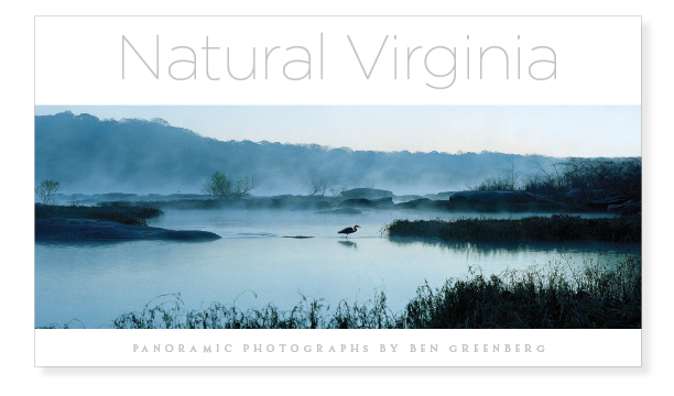
Panoramic Landscape Photographs by Ben Greenberg
|
Click to enlarge |
|
Virginia RegionsTidewater Piedmont Western Virginia |
Western Virginia
(The following is
the
beginning of the Introduction to the Western Virginia
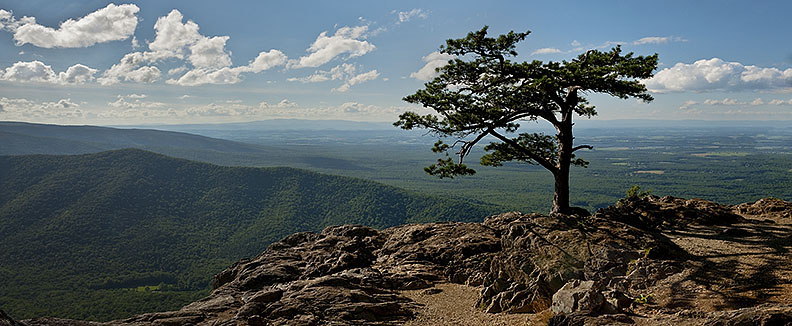
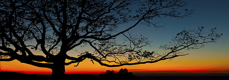
There’s no getting around it – the western part of Virginia is
mountainous. But just
contemplate for a moment the tremendous differences in the panoramic
images selected to reflect the natural character of this part of the
state. The sheer range of
subject matter reveals the complexity behind the simple word
“mountainous” to describe western Virginia.
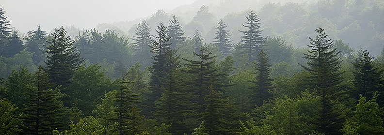
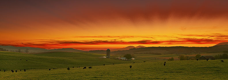
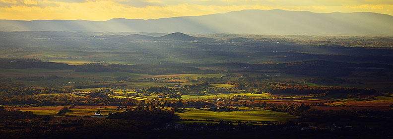
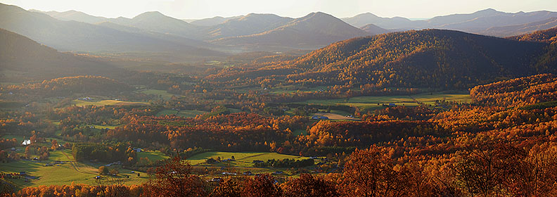
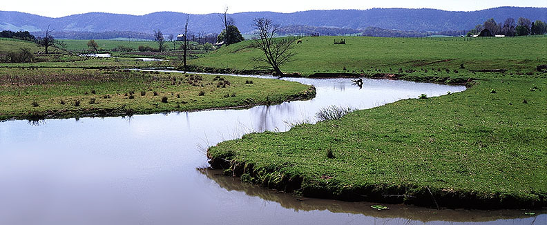
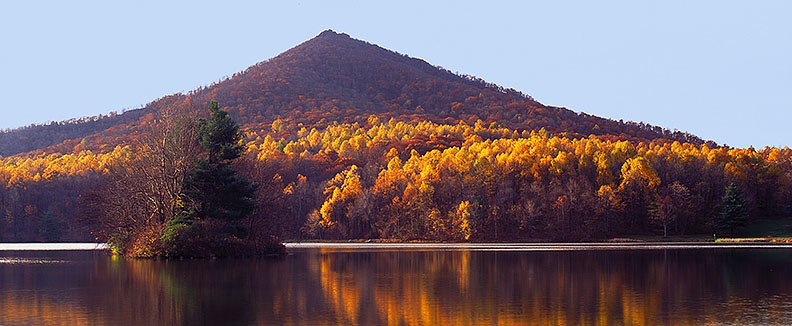
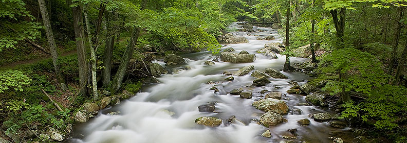
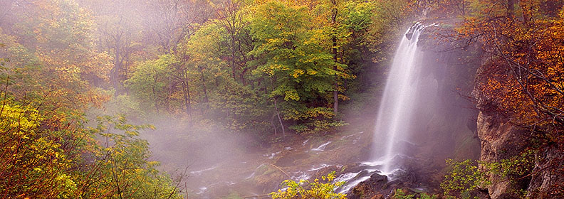
High
meadows, rolling sunlit pastures, moody evergreen forests, rhododendron
thickets, rock cliffs, placid lakes, tumbling waterfalls, pastoral
countryside, expansive vistas—the variety of the selected images is
astounding.
The
explanation lies in the geology. Three of the Commonwealth’s five
physiographic provinces comprise the western portion of the state—the
Blue Ridge, the Valley and Ridge, and the Appalachian Plateau, in the
southwest corner.
Millions of years ago, back in the mountain building history of the
North American continent, large land masses forming the earth’s crust
slipped and crunched their way over the earth’s plates, colliding in
what are known as orogenies, slow-motion fender benders that turned
layers of bedrock on their ear, lifting former ocean floor to dizzying
elevations. Geologists
believe the mountains of the Blue Ridge once rivaled the Himalayas in
height. These crumpled and folded layers of earth have gradually eroded
over the eons, draining the softer rocks away to expose verdant valleys
between the mountain ridges that are composed of harder rocks more
resistant to erosion.
The
Appalachian Plateau forms much of Virginia’s western border and has a
larger presence where it juts into the Southwest corner of the state.
It was too far west to be much
affected by the latest collision of continents, but to the east of that
plateau is dramatic evidence of the crunching effects of earth’s plates
where long, linear ranges of the Valley and Ridge Province trend
southwest to northeast, and contain valleys between them, including the
Shenandoah Valley, the James River Valley, The Roanoke Valley, the New
River Valley, and the Holston Valley.
To the east of these interspersed valleys and ridges is the
ancient backbone of the Blue Ridge, making a convenient eastern boundary
for this western section of the book.
For
those who love exploring the outdoors and more specifically,
photographing natural areas, the western portion of Virginia is soul
food. Here is an abundance
of wild and green places set aside for public enjoyment and protection
of our natural heritage.
Most of the 1.8-million-acre George Washington and Jefferson National
Forests, including the popular destination, Mount Rogers National
Recreation Area, lies in the western part of Virginia.
The Appalachian Trail, one of the world’s longest footpaths and a
work in progress to become even longer, has more than a fourth of its
original 2,175 miles in Virginia and crisscrosses the western portion of
the state to touch all three of the physiographic provinces of this
region. Numerous state parks
and natural area preserves, managed by the Virginia Department of
Conservation and Recreation, provide lakes, rivers, and trails leading
back into shady woods and across sunny fields. Wildlife management
areas, operated by the Virginia Department of Game and Inland Fisheries,
and state forests, managed by the Virginia Department of Forestry, offer
even more hiking, biking and riding trails, waters to fish and canoe,
and woods to investigate.
Several federally-designated wilderness areas and Nature Conservancy
preserves attract naturalists, botanists, photographers, and students of
nature…………………..
|
Copyright ©2013-2014 by Ben Greenberg. All rights reserved.