|
|
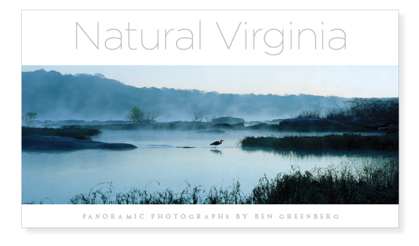
Panoramic Landscape Photographs by Ben Greenberg
|
(click to enlarge)
|
|
Virginia RegionsTidewater Piedmont Western Virginia |
Tidewater Virginia
(The following is the beginning of the Introduction to the Tidewater
Virginia
Region of
Natural Virginia prepared by
Deane Dozier)
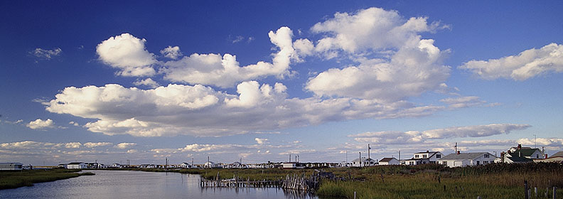
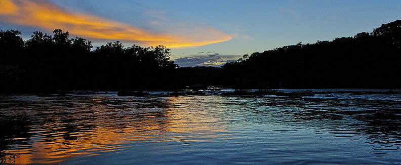
Rappahannock. Tangier.
Chesapeake and Chincoteague and
Chickahominy. Back Bay and Great Dismal Swamp.
For Virginians, the very words can summon the
smell of salt air in the mind, or perhaps stir up a memory of poking
around the tidal ooze searching for clams with the toes.
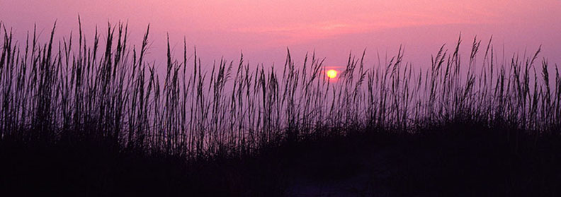
Say “Eastern Shore” or “Sandbridge” and
recall the sound of waves rolling into the Atlantic shoreline, sizzling
up the beach, dissolving into foam.
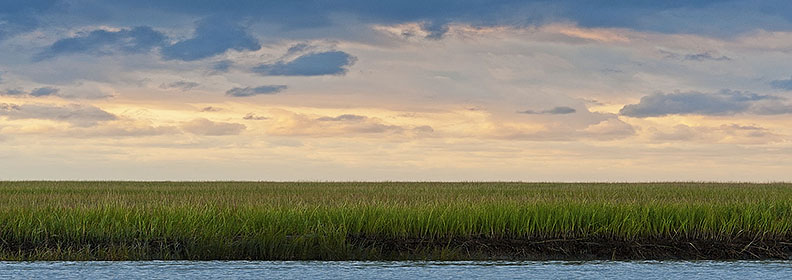
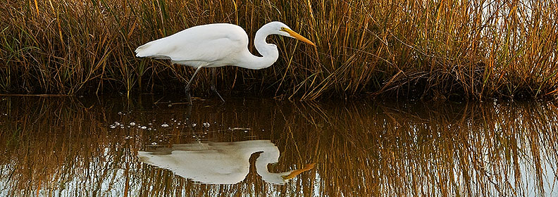
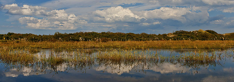
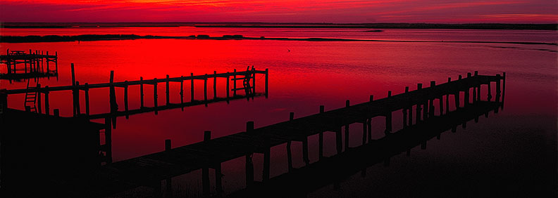
Here in Tidewater Virginia are rich wetlands
where ospreys and eagles nest, wide expanses of marsh grasses where wild
ponies graze, and tidal waters where anadromous fish with an urge to
spawn follow the paths of early explorers upriver to the fall line.
Time spent savoring a salty breeze,
watching porpoise roll through breakers along the coast, poking about a
Chesapeake Bay tidal gut in a small boat, listening to songbirds in a
marsh—all these have a way of seeping into your very marrow, leaving
lasting impressions in mind and spirit.
If the mere mention of a place name has the
power to conjure up sensory images, then viewing the detail in the
photographs of this book is certain to produce beautiful memories, if
you have been here.
Wanderlust, if you have not.
Ben has selected images that reflect
his own favorite haunts from areas east of the fall line—the
physiographic demarcation where rivers from more western counties meet
the coastal plain and become tidal.
What is Tidewater?
The area covered here lies east of Interstate 95, and includes the Northern Neck, the Middle Peninsula and the Lower Peninsula on the west side of the Chesapeake Bay, the Bay itself and its tributary rivers, and Virginia’s portion of the Eastern Shore, as well as the entire southeastern corner of the state down to the North Carolina line.
All 14 of the national wildlife refuges
located in Virginia are sprinkled about the Tidewater area.
Additionally, the Tidewater is home to
30 natural area preserves, five state parks, nine state forests, and 11
state wildlife management areas, as well as some privately owned
preserves of The Nature Conservancy that are open for gentle use.
Some preserves and refuges feature
significant wetlands for marsh birds, or they may protect pristine sandy
shorelines, low dunes, and salt marsh habitat. Others provide protection
for some of the oldest and tallest trees in Virginia.
On preserves and refuges where beaches
border the Chesapeake Bay, wind and water move sand around, creating an
ever changing habitat for rare marsh birds and colonial nesting birds.
Of course, these varied habitats provide
wonderful variety for Ben’s camera.
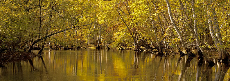
He makes repeated trips to such places
as Caledon State Park on the Northern Neck, with its old growth forest
and largest concentration of bald eagles on the East Coast.
The wild ponies and wading birds add
life to images of the barrier beaches, dunes, marshes and maritime
forests of Chincoteague National Wildlife Refuge and Eastern Shore
National Wildlife Refuge.
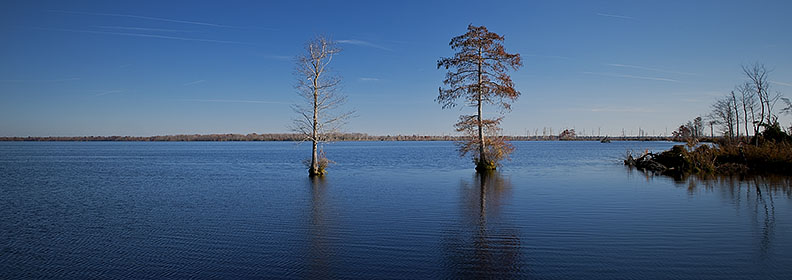
Osprey and bald cypress trees are among
his subject matter at First Landing State Park near the mouth of the
Chesapeake Bay. Back Bay National Wildlife Refuge and the adjoining
False Cape State Park in the southeastern corner of Virginia also have
photogenic
barrier island beach and dunes, shrubby habitat, and brackish marshes.
|
Copyright ©2013-2014 by Ben Greenberg. All rights reserved.